24.05.2025
I have received the results of my last module on my online BA Hons Photography Degree and was pleased to be awarded an aggregated mark of 78%. The subject was to tell a story, and I chose to tell the story of how a sacred spring transforms into a young river over the course of a post industrial landscape in north Somerset, and the collection of its water by people who used it domestically.
The images are monochrome to reflect the use of large format film for many of them and I have included a gallery of those images below, accompanied by the text I included in the submission.
My aim is to continue collecting images of both the landscape and ‘water gatherers’ over the months ahead.


The subject of this photographic project is to tell a story concerned with identity : the identity of water over a small water course, the identity of people who collect that water for their personal use and finally my identity as a photographer.
Originating from the earth as a sacred spring, the water course quickly becomes the focus of a post-industrial landscape, before emerging as a young river. The project is also a study of people who collect this water for personal use, preferring the nature of this water rather than that which flows through their taps at home. Some of these people identify with an ‘alternative’ view of living, which is congruent with the spring’s ancient roots; despite being named after a Christian saint, the spring stubbornly retains its pagan heritage. Many of the people who take the water tell me of its identity; that it has memory, has consciousness and is a living creation. Many identify the nature of this water with research by pseudo-scientists Masuru Emoto and Veda Austin, who photographed frozen water crystals to elicit examples of that water’s varying response to external stimuli.
It is finally a study of my identity as a photographer and my relationship with analogue photography. During this project I have returned to analogue large format photography after a 20 year absence.
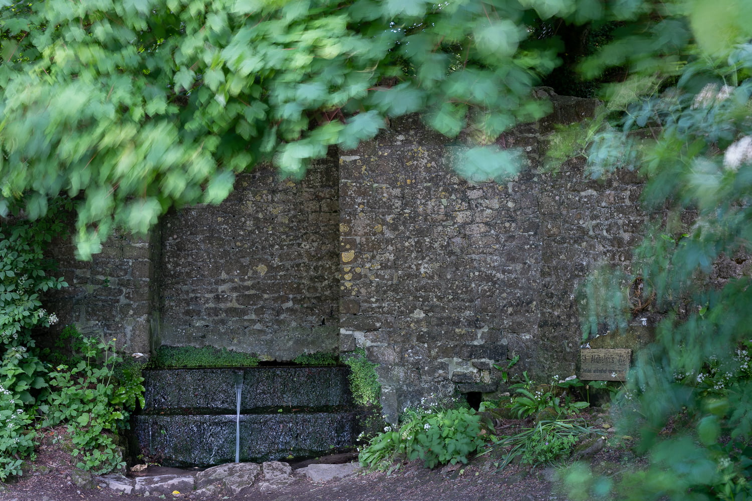
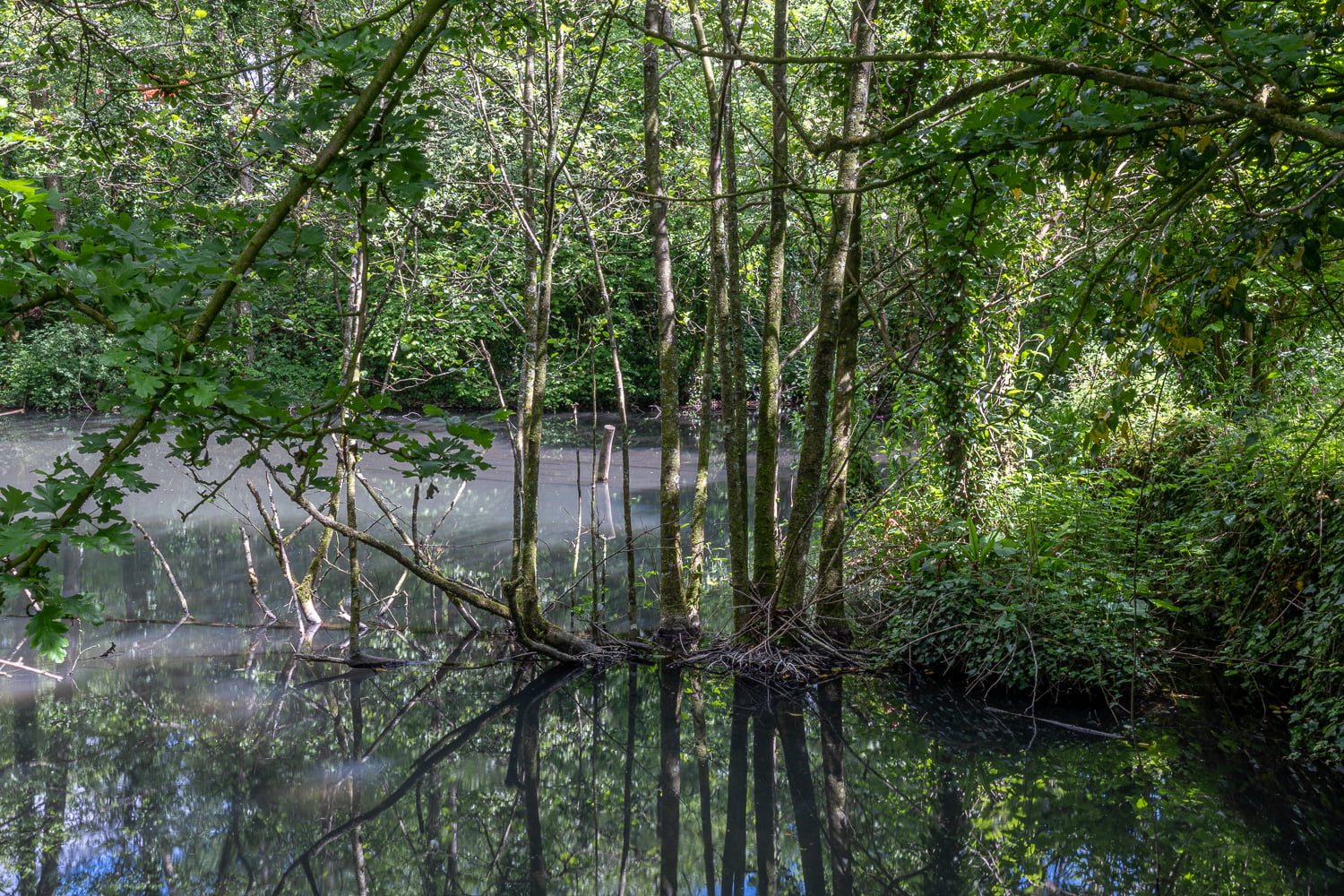
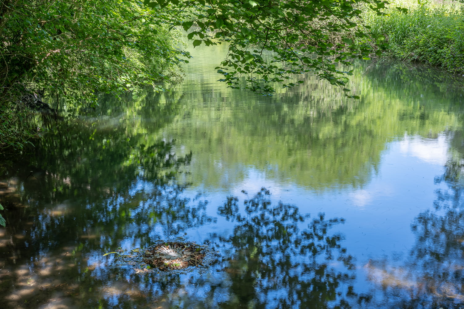
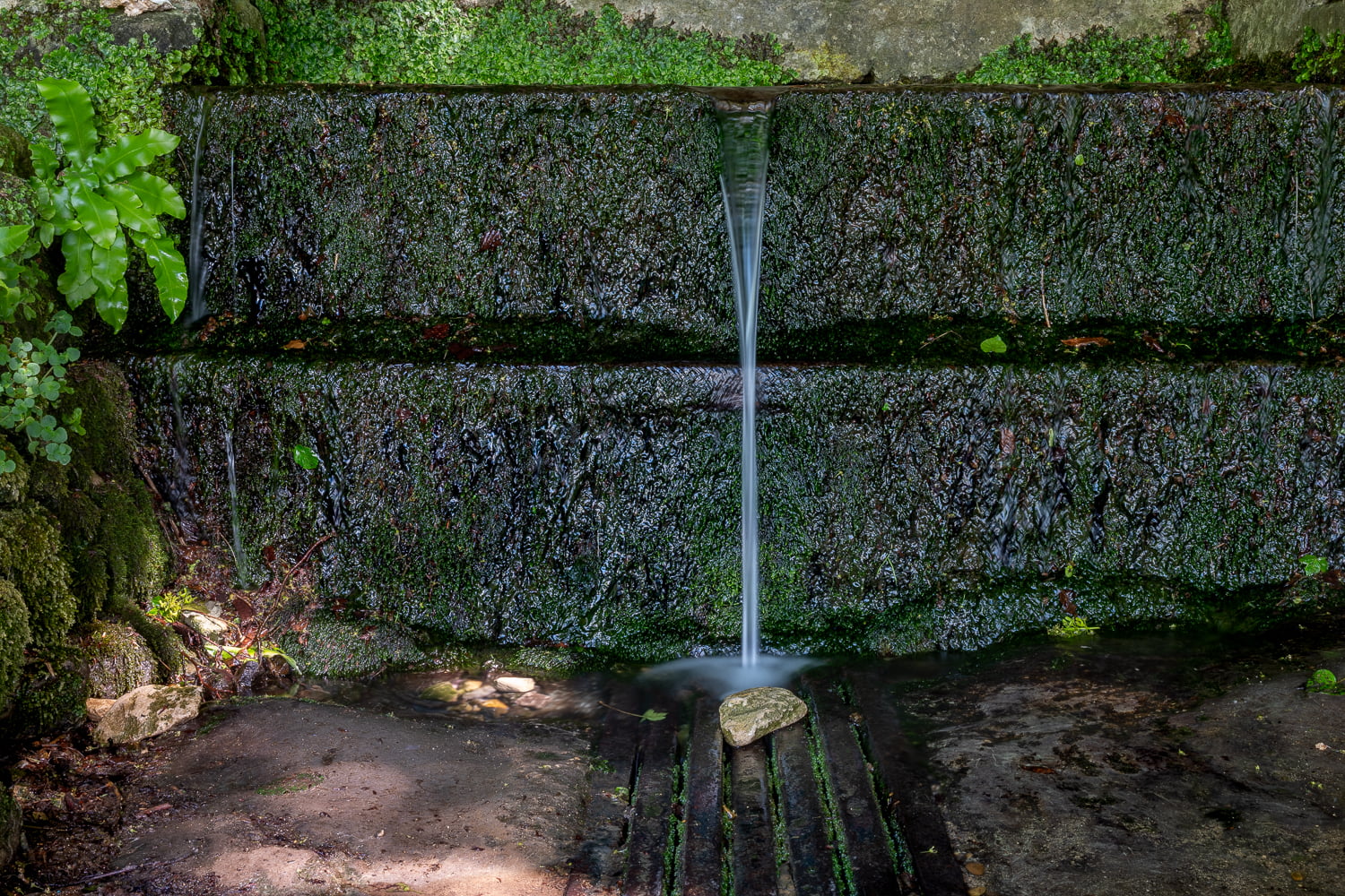
The spring, a healing spring which drew people widely from its locality, was named St Aldhelm’s well in remembrance of a Bishop who died locally in 704 AD. In 1850 the spring was re-routed to drive the waterwheels of a family owned forge which made ‘sharp bladed tools’. In 1905 inefficiencies and changes in industrial practices led to the forge closing. A decade ago the present owner, a geologist, purchased the land and set about repurposing it. Somewhere within its industrialised streams and ponds the water loses its sacredality though is reborn as a new river, the river Sheppey which tumbles down the Mendip hills for 15 miles until it joins the river Brue near Glastonbury.
The first part of this submission features photographs of people collecting the spring water for their personal use. The ‘water gatherers’, as I have called them, are braving the cold weather of January and February, with their water collected in plastic and glass containers. These photographs were taken with a Nikon DSLR camera and a medium format digital camera. The second series of images follows the water course from the spring through man-made culverts, streams, waterfalls and ponds until it leaves the owners land beneath the double strands of barbed wire which delineate the boundary. The series concludes with the spring again, and a photograph of orchids which have been left as an offering.
I initially photographed this landscape using a medium format mirrorless camera, and later returned to make photographs using a 5×7 inch large format Canham field camera with Fomapan 200 film loaded into double dark slides.
Guided by my research into sensation and phenomenology, and by focussing on the materiality of the landscape, I questioned whether photographers ‘discern’ features within a landscape or whether a landscape and its innate features and energies ‘manifests’ to artists who become attuned. I queried whether an affinity develops between a photographer and a landscape , and what the nature of that was. I asked how subjectivity translates itself into objectivity; in other words how that interest and attachment to objects that artists feel translates into images.
The focus on and experience of materiality continued in my darkroom using materials such as 510 Pyro staining developer, a type of film developer widely used by analogue artists in photography’s history.
I drew an analogy with American large format photographer Paul Caponigro, who always looked to discern materiality in the photography he undertook in his exploration of the world around him.
08.01.2026
I returned to the Well today; the weather was atrocious, pouring rain. I photographed for some 30 minutes but, thinking my camera had stopped working as a result of water , i stopped working. Miraculously my camera came back to life in the car and i decided to accept the win and return home. Here are some images from today.


03.01.2026
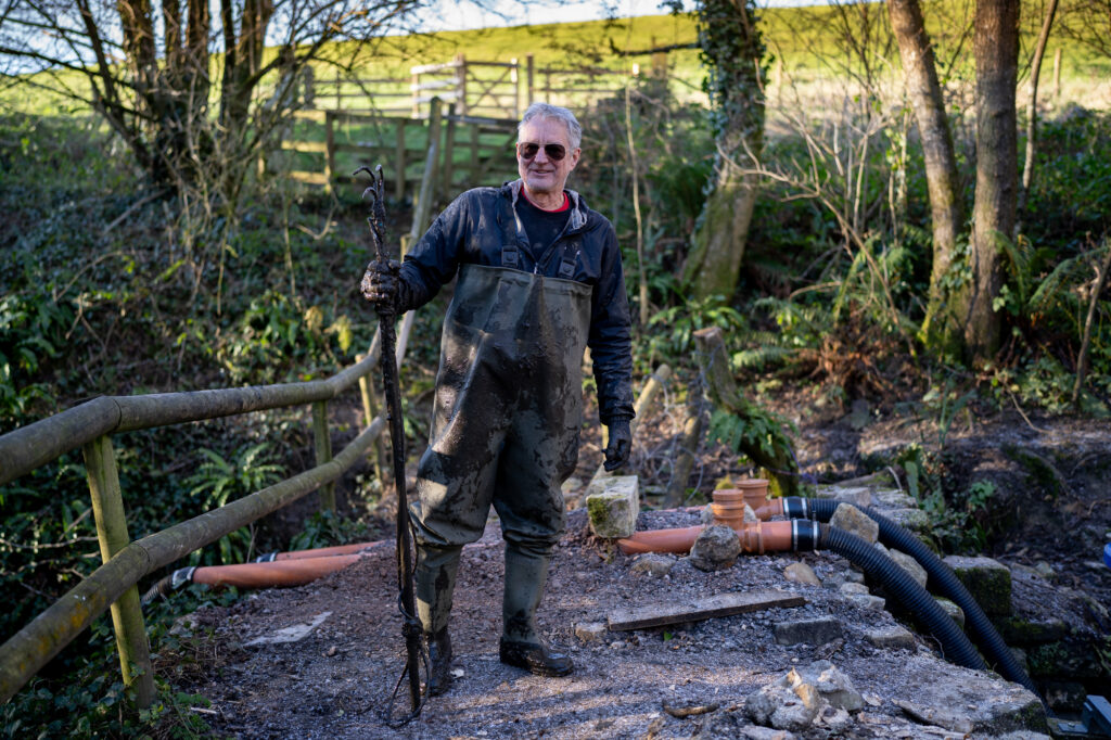
I have been returning to St Aldhelm’s Well and the ponds beyond intermittently since the summer. I include those images below in a series of galleries. The weather has been varied, including very dull days. Today there has been frost and bright sunshine, and it was a pleasure making more photographs. The owner of the ponds, David Entwisle, has been busy restoring them, and i met him today dredging the first pond by hand. Here is a portrait.
When i have sufficient images, my goal is to create a book joining images of the special landscape here with portraits of the ‘water gatherers’, those who collect the spring water for personal use. The images below include many overlaps and duplications, as well as comparisons between colour and monochrome images. It is a living, working collection of images of varying interest made over 1 year from which i will make a series of decisions. I began photographing here in January 2025, and envisage joining 25 images of landscape with 25 portraits to form a piece of work of 50 images.
Now the vegetation around the well has cleared again I can return to make more portraits.
Today’s images are slightly different. I decided to make photographs keeping the lens at mostly f1.4, and selecting specific focus points, allowing much of each photograph to fall into un-sharpness. I think it reminds me of memory decline, where reality becomes focussed onto narrow sharp edges, rather than being something which exists universally that we move through effortlessly. My 6 months of recent illness has been characterised by periods of confusion which is probably a combination of nerve damage and hyper-glycemia. It is interesting to portray different realities visually, whatever their aetiology.
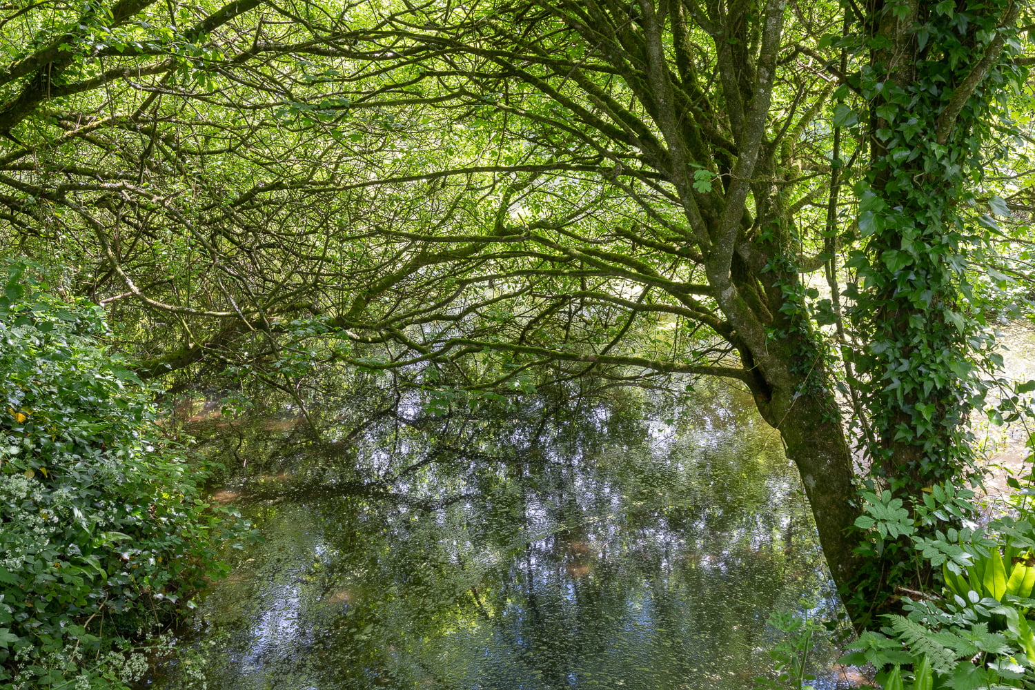
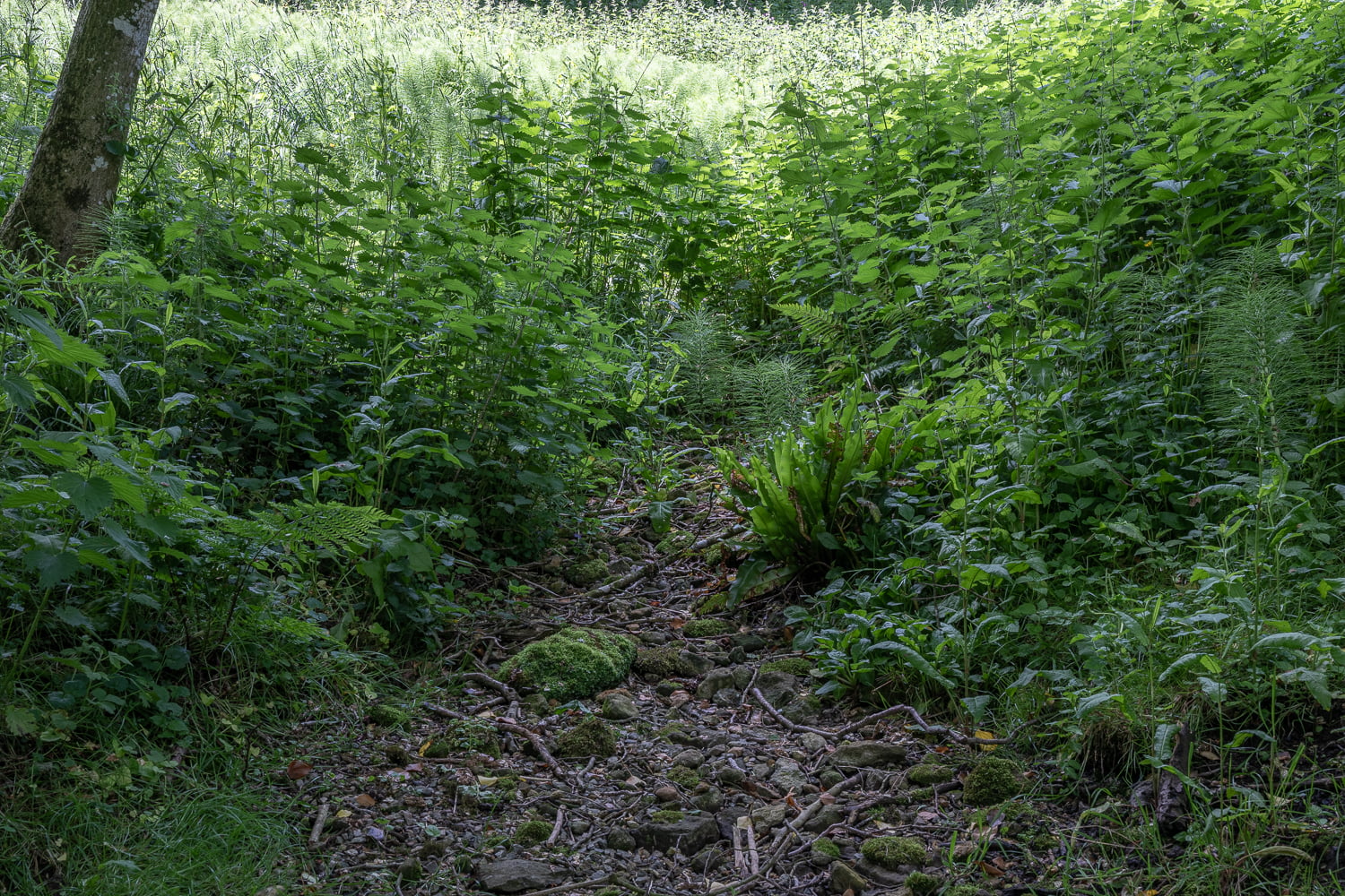
I have concentrated on how I see the landscape; the trees, the water, the gates, the tape which David uses to guide walkers through it, the ruins of the forge, the emergent river, the weirs, the foliage, the syphon-pipes David uses, the waterfall at the heart of the water system, David’s incipient orchard…all of which are deconstructions which eventually I can re-construct to form a composite landscape which suits my vision. I am increasingly of an opinion that those desconstructions vary from visit to visit; although there is much visual overlap, i see new things on every visit. Whether it is me changing or the landscape changing with David’s efforts is an interesting discussion. I am sure it is both.


2025.12.05


2025.10.17


2025.10.11


2025.10.09


15.01.2025

Ideas for photo projects come in a number of different ways. For this idea, it has evolved in its own particular way and now has a number of different potential sides to it.
I began photographing people at the Well today ( a photograph of someone bathing in the Well above ), visited the water course and ponds with a yoga practitioner 4 days ago for her to assess whether she might want to make photographs with me, and have collected a large number of photographs over the last 3 visits. I will post Galleries and more information here as I continue to make contacts, organise things and process images.
It is my wish to use images collected here for the next module of my online Photography degree with Falmouth University, and have to present a proposal in the days ahead.
04.01.2025
I have decided to revisit this fascinating site and to update both the images and the narrative. Below is a collection of new images which will later be further edited and reduced in number to complete a project potentially for my BA Photography course at Falmouth University. These images were collected on Friday 3rd January 2025.
My hope would be to visually explore the presence and influence of the water courses through the landscape, linking in with the St Aldhelm Holy Well theme. I would like to add a divine local figure within the landscape in several images to complement the theme.


Below is an archaeological report documenting work undertaken on the Doulton Tools Edge Works supplied by David Entwisle.
Original post 2022
On a journey between the north Somerset towns of Wells and Bruton, I decided to stop for a while at St Aldhelms Well, near the church of St Aldhelm at Doulting. Both the church and the well were apparently named after Aldhelm following his death in the immediate vicinity whilst on his ecumenical rounds as the Abbot of Malmesbury Abbey and Bishop of Sherborne. he was well known and revered throughout the church as a poet, scholar and theologian. Following his death in 709, his body was returned to Malmesbury and he was buried at Malmesbury Abbey. He was also sanctified and his Feast Day is the day of his death, 25th May.
Arriving at the bottom of the narrow lane, I saw the figure of a man washing himself in the flowing waters of the well. It was a warm sunny late May day and I was pleased to see someone invigorating themselves in the ancient spring. A woman then arrived with a collection of large plastic bottles for filling at the well, and we entered into conversation whilst we waited for the man to finish his ablution. She told me the water here was very good for drinking, and made a fine cup of tea, much nicer than the popular White Spring at Glastonbury which she said was ‘calcified’. She told me that the best spring for drinking water however was at Whitehole spring, where it was actually commercially bottled and sold, though it is still possible to collect water for personal use there without charge.
It still amazes me the number of people who, perhaps correctly, do not trust the quality of tap water, fearing it contains a wide range of additives and pollutants, and continue to collect water from natural springs. I have long considered undertaking a project of taking portraits of some of these people and collecting some information as to how far they travel for their water, and also to ascertain whether they undertake any rituals with the water they collect, potentially ascribing some spiritual value and quality to their ritual.
The man finished his washing and walked across the narrow road and entered a gate into a driveway where his car was parked. The drive appeared to be at the head of a footpath which wound its way down into a some trees and undergrowth, with the burbling channel of water from St Aldhelm’s Well running along beside it. The woman began filling her bottles and I readied my camera for when she had finished her collection. As she finished, the man returned and also began having a conversation. He said he owned the land nearby and, with the water from the spring that fed St Alhelm’s Well, there were other springs on his land, and a series of ponds, which together formed the head of the River Sheppey. Intrigued, I enquired whether he could show me these springs and ponds, and he kindly said yes.
Wondering whether my footwear was appropriate, we set off nonetheless along the footpath, beside the little brook and into the leafy grove of trees.
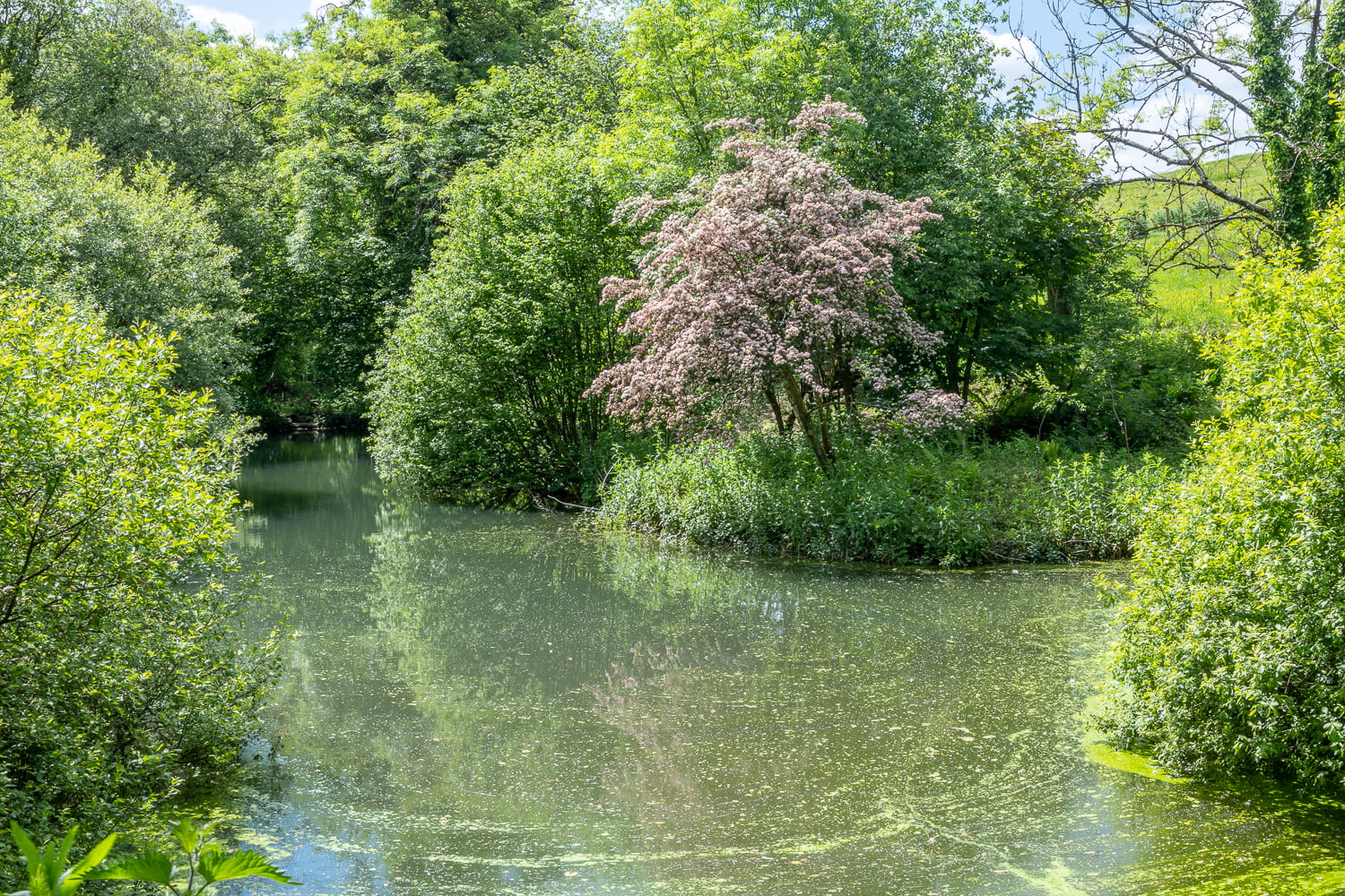
Almost immediately a pond with a Hawthrorne bush along its banks came into view. The bush had lost its white blossom which had now turned pink, my host explained. He said he bought the land, approximately 3 acres, in 2014 and in between working for periods as a geological engineer across the world, had undertaken to restore the ponds and waterways as much as he could. He also said that the site was formerly used as an industrial complex where a water driven forge mill produced edge tools for use commercially. I later read that around this part of Somerset there were many industries, both agricultural and industrial, which depended upon a ready supply of bladed tools. These might have been billhooks, axes, planes and even tools for the coal industry which existed in north Somerset several hundred years ago. I investigate this further below.
As we talked we walked further into the complex, and it was clear that water management systems of sorts had been built and David had tried to restore as much as possible.
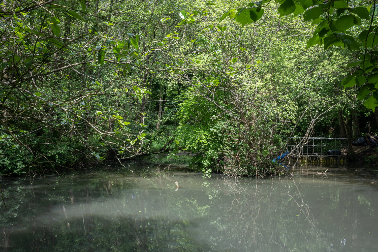
What struck me was that even though this was obviously once an industrial landscape, where the ponds were systematically linked to provide the best supply of water to the mill at the bottom of the series of ponds, it was now semi-wild and untamed again. David pointed out the sluices, channels and culverts which facilitated the water flow, but much had been damaged and the size of his task looked overwhelming.
The restoration included cutting back of overgrown vegetation, developing better footpaths and access paths around the ponds, both clearing and re-establishing springs and waterways, making old industrial structures functional and safe again and also building into the landscape here some enjoyment and recreational structures for himself. He said he often camped and lived on-site, especially in the summer months, when he described the range of wildlife he co-habits with as astonishing.
Currently, the ponds have become ‘disturbed’ and silted up, giving the milky appearance within the photographs.
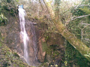
We eventually arrived at a small watercourse, where a trickle of water could just be seen between the stones and scree, and David said this was the principle spring ( below ) from his land which fed the ponds. He said the flow was seasonal.
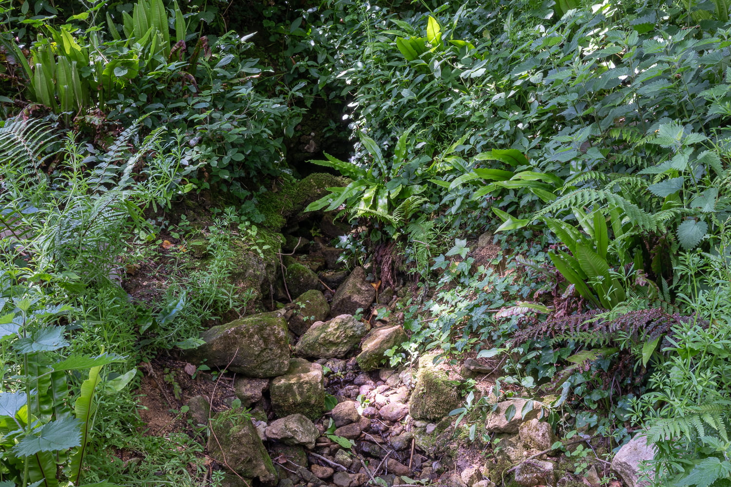
He next pointed out the secondary spring ( below ), currently dried up, which again produced a greater flow in the autumn and winter months. It is interesting to contrast these 2 springs with the spring which feeds St Aldhelm’s well, which has never been known to lose its flow.
The second pond has a drainage hole which David has restored and has also supported by attaching a metal cap ( below, bottom of image ), which prevents blockage by leaves and branches, and this leads by culvert firstly and then by freeflowing down a channel to where it formerly propelled a mill wheel, no longer in situ. This in turn drove the grinding stones and possibly the bellow/forge machinery which fabricated and sharpened the blades.
At the bottom of the water cascade the remains of the actual mill workshops are in extreme disrepair and are unsafe. There is little left of the workshops other than external walls. The history of edge tool manufacture is interesting, especially in the west country, which was isolated from the rest of England before the arrival of the railways ( the canals mostly reached no further west than Bristol ). Somerset in particular had a strong edge tool industry until the collapse of English agriculture in the 1870’s.
A description of this industry can be found here, on a website called ‘ A Load of Old Billhooks’. It suggests that :
“The Mendip hills to the west of Frome have an underlying wealth of minerals, and even though coal mining ended in the 1970’s, quarrying of limestsone for road building is still a major industry. The demand for edge tools for mining, quarrying and agriculture created a local response during the 18th and 19th centuries, with the fast flowing streams fed by the high rainfall from the Atlantic Ocean to the north supplying water power.
Most edge tool works were situated on the southern and eastern flanks of the Mendips, from Frome to Shepton Mallet. A few were located around Bristol, on the Somerset-Gloucestershire borders.
The coal seams ran roughly north-south, from Bath to Coleford, with the largest mines in the Radstock/Midsomer Norton/Paulton regions. Colliers had a requirement for picks and shovels, both of which wore rapidly and had to be replaced. Most pits had a blacksmith’s shop where picks could be reforged, hardened and tempered to increase their life, but most tools would have been bought in from edge tool makers.”
The above image shows the tilt hammer at Gurney Slade shortly before demolition to make way for a Bristol Water Company works. Note at the left the large cam, operating the shears to cut the bar into working lengths.

Much more fascinating information can be found on the Billhook website.
Regarding specifically the Doulting site, the website offers the following :
“Robert Coombs had an edge tool works at Doulting, on the ridge above Shepton Mallet. There are the remains of two ponds built (according to the town council) by a relative of the Fussell family of Mells. I had been told that Steeds operated there (as that firm was run by James Fussell Steed, there may be an overlap of information). More research is needed… there are the remains of a launder supplying an overshot wheel.
The remains of the feed to a water wheel on the site of the edge tool works at Doulting. Note the brick ‘voussoir’ arch in the centre of the picture.
Handlemaking for the edge tools was also a local trade – as well as William Fussell’s works in Mells, there must have been other makers. A Handlemaker Road in nearby Frome is evidence, as well as family history (the family of an Eliza Cooper of Nunney who were carpenters by trade ‘crafted’ wooden handles for edge tools. A William Clarke is listed in the 1891 Census for Mells as a handle maker, presumably working for Fussell.”
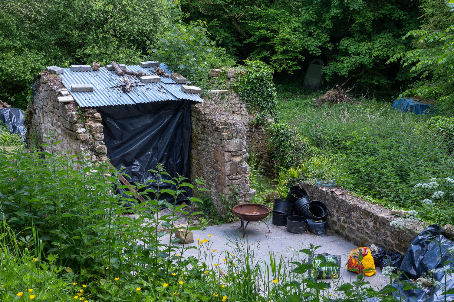
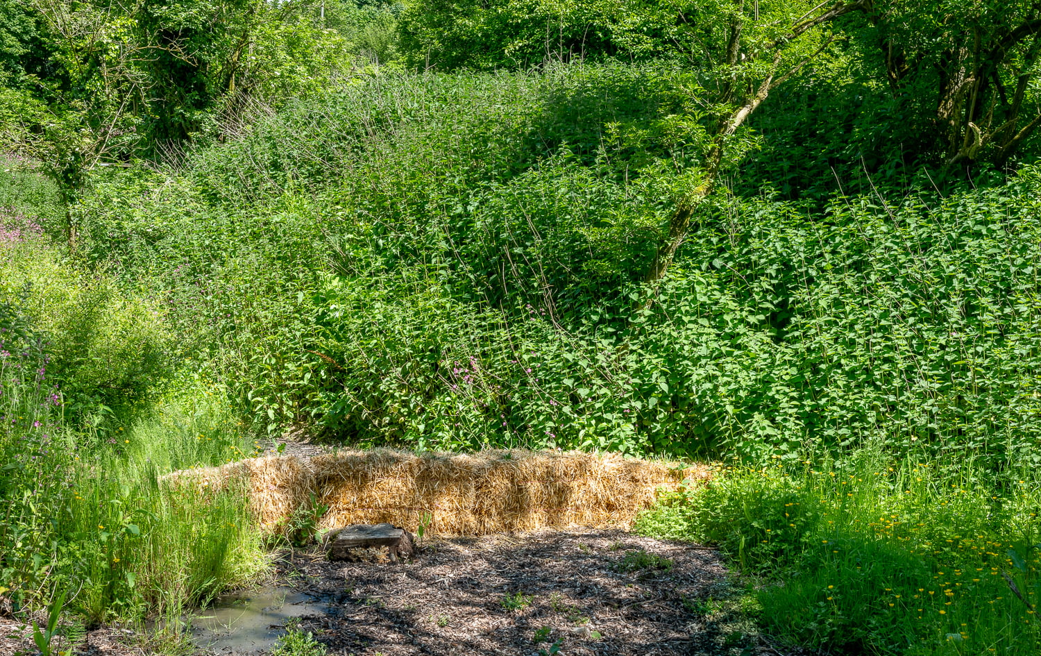
The image above shows what is left of the industrial buildings. In an effort to clean the mud and the silt from the ponds, David has set up a filtration system using straw to separate the silt ( below).
The lower part of the complex, around the mill workings and further down to where the springs and ponds flow finally combined as a unified waterway, perhaps for the first time actually becoming the river Sheppey, David has developed the landscape further, planting new plum, pear and cherry trees to supplement the ancient indigenous trees, maintaining a sward of cut grass which can be used recreationally as he wanted and a spot where he pitches his tent for sleeping.
The Sheppey finally makes it way out of David’s land under a canopy of wild garlic ( below ), down Doulting Hill and into the grounds of Charlton House, before servicing other local mills such as the silk mill at Bowlish and those at Darshill, passing the old pumping station which used to supply its water to the Anglo Bavarian Brewery at Shepton Mallet. It seems to have had a considerable history as an aid to local industry and travels altogether for almost 20 miles before it joins the river Brue.

The visit to Doultings Edge Tools Mill and ponds was entirely fortuitous and began only by stopping at the ancient St Aldhelm well and talking with strangers. This event was slightly ironical, as a few days earlier I had been having coffee with an old friend, who is now in retirement a stand up comedian, and we were only talking about the benefits of taking journeys and talking with the people you met on-journey. We somewhat disparagingly called it ‘talking shxt with strangers’.
For me the interest here has been the wide ranging, almost ubiquitous, conscious presence of water in many people’s lives. Whether it be the river Ganges in India, the springs in Morocco or the waterways within Somerset, there is a universality which is difficult to ignore
The final image is the spring at St Aldhelm’s well, which draws many people to it for its ‘alive’ qualities and who mostly reject that received from the tap in their homes.
References :