The Somerset coastline stretches for some 80 miles from just south of Weston Super Mare to west of Porlock Weir, the former at the new boundary of North Somerset and the latter within the boundary of Exmoor National Park. The Bristol Channel has one of the greatest tidal ranges in the world, a phenomenon which engenders problems with mud and silt and management of its shores, maritime passageways and harbours. The Channel also retains a permanent muddy ‘brown-ness’ to its colour, it is rarely or never ‘blue’ like many seas.
Extensive mud flats make some parts of the coastline dangerous for boats, fishermen and walkers, and mud is present along its entire length. This is the beginning of a series of images documenting parts of this coastline over the winter of 2023/2024.
I hope to record here the better images on a photographic day to day basis as the project continues..
Progress
Day 17 : 27th February 2024 Mouth of the River Brue


Day 16 : 5th February 2024 Mouth of the River Parrett


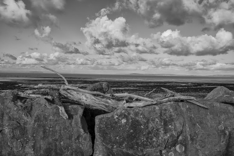
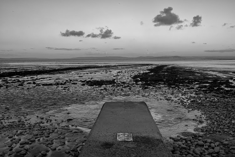
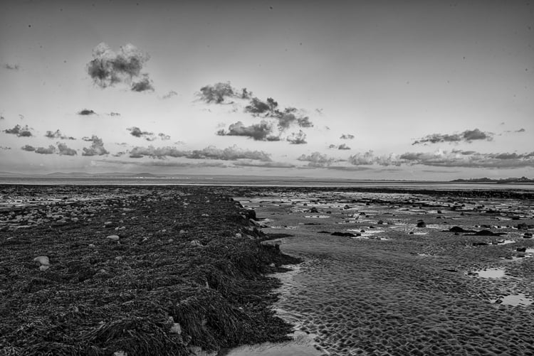
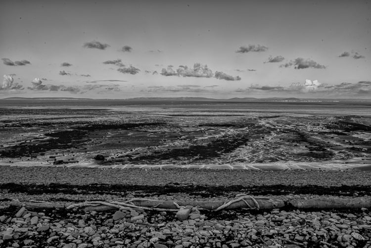
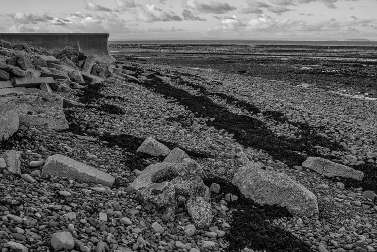
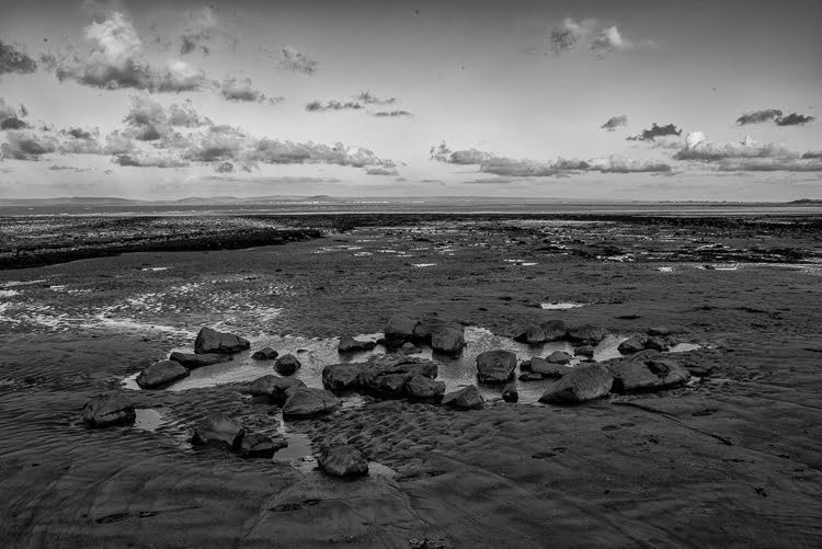
Day 15 : 15th December 2023 Lilstock Beach


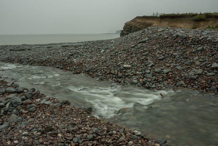
Day 14 : 9th December 2023 Bossington


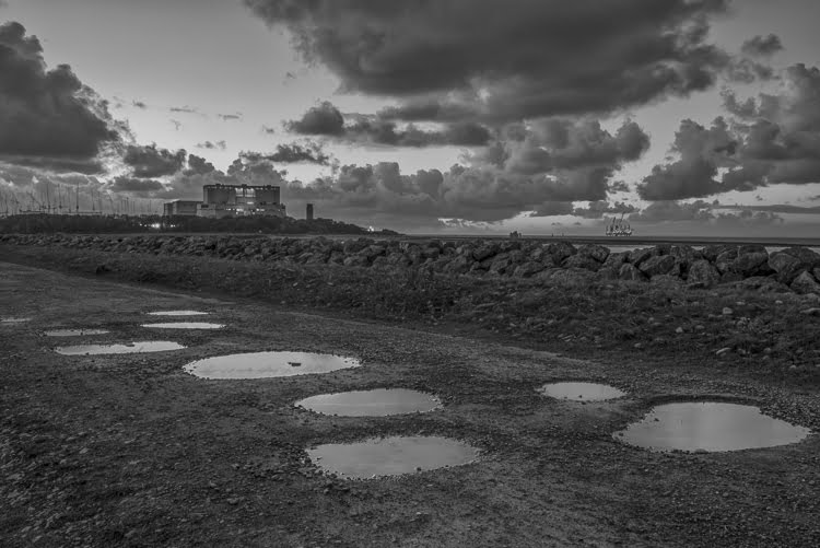
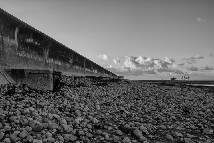
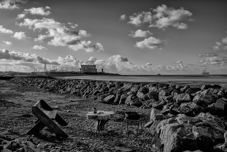
Day 13 : 8th December 2023 Combwich
Combwich is a small village on the river Parrett nearing where the river joins the Bristol Channel. An ancient port and ferry point over a seam of blue lias rock, it is now silted up though has recently been partially reconstituted and a wharf has been constructed which receives barges containing materials for the nearby Hinkley Point construction site. It is believed that pilgrims travelling from north Devon to Glastonbury might have used this ferry point rather than cross the dangerous Somerset marshes.
A footpath follows the flow of the river alongside the playing fields to the birds hide, where the path left veers towards Steart, but continuing along the river bank continues onward as far as the ‘breach’, a recent waterway cut to allow the drainage of Steart marshes.
The Parrett has become a wide river by this point, with extended graceful curves leading ultimately into Bridgwater Bay. At high tide its channels of silt and mud remain obscured, only to reveal as the tide recedes.
In my last post I referred to photographers who have influenced me over the years. Initially the large format photographers of California took my attention, firstly the ‘Dust Bowl’ photographers followed by landscape photographers. The photography they undertook, using large wooden field cameras on which they composed images on ground glass screens under large dark cloths, was, I considered, amazing both for the content, clarity and artistic vision of those artists. What I didnt understand then, and learnt to more fully appreciate, was the political nature of the work they produced.
The ‘Dust Bowl’ era refers to the time of the great depression in the USA during the 1930s where the USA government employed a group of photographers to document the hardship of small American farmers in the south. The majority if not all the photographers used field cameras to create heartbreaking images of the refugee farmers who travelled and the plight of those who remained on the farms they endeavoured to maintain. Well known photographers include Walker Evans, Dorothea Lange and Carl Mydans. The first photographer I really appreciated was Walker Evans.


Day 12 : Ist December 2023 Kilve (revisited )
I returned to Kilve on the coldest day of the year so far. I was surprised to find under light cloud the temperature was relatively mild. Kilve has been a beach I have visited for many years. Its fascinating geological formations are visible both in its exposed cliffs and the stratafication manifesting as rows of lias and slate which recede down to the sea. The river Holford enters the beach as a single narrow channel but quickly fans out to many riverlets flowing under the many pebbles at the head of the beach and through the many channels formed by the rock formations. I have found the many water courses entering the Bristol Channel through the Somerset beaches one of the joys of this series of photographs.
Wearing wellington boots allowed me to photograph wherever I wanted along the river course and the rock pools and expanses of water contained between the rock formations. There were few other people on the beach. Although able to walk extensively along both ways of the coastline, I remained mostly near the entrance to the beach, where the river flows into the Channel.
I feel there is a growing psychological and creative adjustment occurring as I continue to explore the coastal landscape, and focus entirely upon photography of a rural landscape. It is very different than photographing the urban landscape of Bristol and the spiritual landscapes of both India and Morocco. Whilst photographing on Kilve beach I reflected on my earlier readings and studying of iconic phototographers, espcially those mostly American photographers who captured landscape on their wooden plate or field cameras in the early to mid 20th century; photographers who strove to find something contemplative and transcendant in the work they produced. These photographers included Edward Weston, Paul Caponigro, Minor White and Wynn Bullock. In fact Minor White endeavoured to translate his study and embracing of eastern religions into his photographic art.
This series begins with several studies of the river Holford before several images of the geology of the cliffs and finally the bulk of images depicting the wider expansive landscape of rock, light, cloud and distance looking west towards Minehead, east towards Hinkley point and north towards the southern coast of Wales.
This psychological change is subtle but interesting. Many of the photographs of this series are of light, cloud, foreground, horizon and perspective. There has been a consistency of one camera and one lens. The variation is of the weather, light conditions , cloud formation and geographical changes. The sea has not formed an important apsect of the photographs; the photographs have almost all been taken at low tide, and this has been by accident not design. High tide I feel would have resulted in entirely different photographs.


Day 11 26th November 2023 Kilve
Kilve beach is a fascinating piece of coastline, with oil-rich shale and layers of blue lias rock which holds many fossils. It rained the entire time I was there. The river Holford, which rises in the Quantock Hills behind, flows into the Bristol Channel.
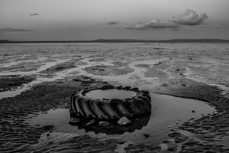
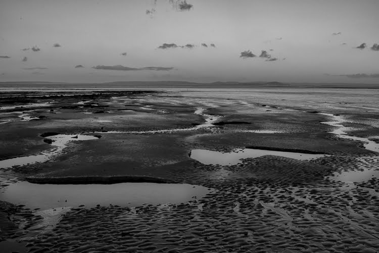
Day 10 25th Novmber 2023 River Parrett Estuary
The Parrett estuary is unkown to me. I have never explored the region between of the mouth of the river Parrett along to the mouth of the rivers Huntspill and Brue into the Parrett, and the Parrett’s emergence into the Bridgwater Bay and the Bristol Channel besides Burnham on Sea. This is a distance of some 10 miles; approximately 1/8th of the entire distance of the coastline.
The region appears to be mostly nature reseves; a low lying wilderness where only several small hamlets ( Pawlett, Stretcholt, Alstone and West Huntspill itself ) denote habitation. Access to the stretch of waterway seems difficult by car; only several ‘off road’ tracks lead down to the water, although a footpath stretches along its length. Both the A38 and M5 carriageways run straight just a few miles inland.
These images are not strictly on the Somerset coast but it maybe argued that the Parrett, a tidal river, becomes a part of the Somerset coastline for many miles inland at every high tide, espcially so at spring tides. The silt and mud from the Bristol Channel is deposited far inland.
The river Parrett widens considerably just beyond the town of Bridgwater and before its mouth which issues into the Bristol Channel. These photographs are an introduction for me. I shall need to return and make more photographs.


Day 9 : 21st November 2023 Steart
I travelled mid-afternoon down to Steart, a small hamlet on a spit of sand and mud at the entrance to the river Parrett in the Bristol Channel. It is a winter migrating spot for wading birds. A large part of the shoreline is closed off to walkers in order to protect nesting birds and the wider world-recognised sensitive landscape.
The higher shoreline incorporates some pebbles and shingle, some dunes and grasses and just behind it are extensive salt marshes. A single road bisects the shoreline and the marshes, and the latter extend across flat landscape to the Quantock Hills several miles behind.
The weather was cold and I had limited time. Colour was again in the sky, but more varied than further west towards Minehead. This may be a reflection of the greater concentration and deposits of mud here; great mudflats extend into the Channel and into the mouth of the Parrett and that mud continues to silt the Parrett far inland. The tidal flow extends out for miles into the Channel; the gentle roar of the churning sea can be heard but the brown waves fold into the similarly coloured mud flats and in the far distance the two are indivisible.
The colours in the sky and clouds frequently change and range from orange and yellows to cobalt blue. There are faint patches of colour to strident bands of intense colour. The clouds banks are extensive, both long and narrow, and billow occasionally into great headlands of cloud. In the cold breeze they are frequently changing.
This area, around the mouth of the Parrett, and the mudflats extending across Bridgwater Bay to Burnham on Sea and even eventually Brean Down, seems somehow the centre of the Mud Line, the area where the seascape as a creation and effigy of mud comes into its own. The colour brown seems to have a locus of intensity,
The landscape is relatively easy to document; exposing for the highlights is an exposure convention which serves well here. At times somehow the tonal range seems compressed into a high intensity of narrow bands of illumination; a common feature of seascapes where the sea reflects the sky and light is abundant.
Later, in post-processing, the colour range of images proved difficult to work with. Could the colour range actually be a true reflection of that experienced? Earlier considerations of whether to portray images as monochrome seem redundant now. I recalibrate my monitor and reproduce the photographs below as they are recorded, and will leave final decisions regarding this until later.


Day 8 : 17th November Porlock Weir
I had intended to photograph Bossington beach and then maybe nearby Porlock Weir, if there had been sufficient time. The heavy rain truncated the day and I spent a couple of hours in the little town of Porlock before driving down to Porlock Weir just a few miles along a winding lane. Clouds hung heavy over the Weir, there was little colour anywhere and also little light. There was no wind at all; everything was still.
The photographs are almost all from a small area alongside the stream which flows out of the small harbour there and down into the Channel. When the tide is high the stream is invisible and the incoming tide fills both the habour, around which there is a cluster of hotels offering coffees and foodstuffs, and also a muddy creek which turns a sharp right in the harbour and follows the coastline for about a hundred yards. This is filled with boats and yachts sitting in the mud. I would like to return and photograph that area another day, along with the Salt Marshes and the oyster beds just a little way along the coast.
There is a photograph of the remains of a large whale deposited by the tide.
The images from today are almost monochrome, and the colours within them are subtle greens and purples. I could translate them into monochrome but I am currently enjoying the colours, even if they are muted.


Day 7 : 15th November 2023 Doniford Bay
Another bright day. Parking at Doniford was difficult; the old car park was now closed and there was limited room for parking on the narrow road between Watchet and the busy A39 coastal road. Doniford has always been a popular beach for fossil hunting.
It is a much sandier beach than St Audries Bay, though there are still plenty of striations of rock further down the beach. It is saddled between 2 holiday camps, one at each end, but it is a wide bay, with a feeling of plenty of space. The cliffs are much lower along its length which maybe lessens any feelings of claustrophobia.
I photographed for 2 hours; the clouds again were painted with autumnal light all the time I was there. The natural beach contours, water pools and rock features worked well with the distant sea, horizon and large banks of clouds. Some man made remains formed interesting centrepoints for images. The Doniford Stream, which rises on the Quantock Hills at Triscombe and Crowcombe, issues with a rush into the Bristol Channel, the last part of its journey is known as the Swill.
I am continuing to make photographs with a Nikon d810 digital single lens reflex and a Nikon 35mm f1.4 lens, using an old tripod for stability. This arrangement keeps my vision simple; I am not having to consider lens choices and different angles. I believe, as well as maintaining a single vision, this brings uniformity to the photographs I am taking.
Initially I was considering undertaking these photographs in monochrome; it is now apparent that colour has assumed a primary role, and the use of late warm light and a single lens has encouraged the development of a style. It will be interesting how this progresses further.


Day 6 14th November 2023 St Audries Bay
Heavy rain in the morning passed into a sunny afternoon. I had never been to St Audries Bay and resolved to find and visit the bay. Parking was in a private holiday camp, and the pathway down onto the beach was well looked after and quite steep. Steps eventually led down onto the pebbles. Either side were cliff headlands but the bay curved in an arc between them, quite an expansive bay with typical geological rock formations in both the cliffs and running along the beach in two directions, but mostly down towards the sea. In between the pebbles were areas of gritty sand.
I only had about an hour and the light quickly faded, with warm changing colours in the clouds for most of that time until well in to dusk.
The waterfall was just around the right hand, and closest, headland, and its beauty surprised me. Photographs I had seen had not done it justice. The heavy rain of the last day or two had swelled its flow I guess and its waters gracefully fell down the red cliffside onto rock below from a stream source above.
Along the beach is interesting relics of both metal and wooden structures, I guess decayed mooring structures for boats. Along the cliffside beside the path down was the remnants of a substantial building hugging the cliffs. An interesting location looking over the Bristol Channel towards the coast of Wales beyond.


Day 5 : 11th November 2023 Watchet beach
A beautiful day with soft light. The photographs here are all colour and feature predominantly views across the mud flats and Channel to south Wales and the geological formations and patterns of the cliffs.
The walk from watchet along the beach can be quite difficult in places; large pebbles, rocks and areas of muddy sand until a large expanse of sand is reached makes walking arduous. The geology of the cliffs here are astonishing, with large chunks of cliffs from landslides lying on the foreshore, their colours and patterns varying along the walk. Photographing the large part of cliff exposing its geological structure was my main intention, this is quite a walk along the beach, maybe half a mile, and takes a good 20-30 minutes.


Day 4 : 8th November 2023 Minehead


This afternoon was spent in Minehead, around and beyond the area of its harbour and its ancient public house The Old Ship Aground. This excludes the main promenade and beach area with its line of holiday camps ( primarily Butlins ) amusement arcades, fish and chip cafes, hotels and the terminus of the West Somerset Railway. I assume the harbour area, and the winding lanes of North Hill above it, is one of the oldest areas of Minehead.
The Coast Path winds its way beyond The Old Ship Aground, initially along the pebbly shoreline and then into a small Park area before becoming a path leading around North Hill towards Bossington and Porlock.
It was cloudy today, with no sun coming through at all, but the clouds where light and high and there was plenty of light illuminating shadows. The shoreline, some houses and the area of the Park interested me; a departure from the beach areas of the earlier 3 locations. The photographs are above.
I deliberated on the nature of landscape photography; there were no ‘hero’ photographs today, more a reflection on ordinary structures alongside a range of coast. Reflection and meditation on the ‘ordinary’ was interesting and challenging in a very different way and somehow veered creative instincts away from an exploration of visual extravagance. Differences between monochrome and colour again played on my mind and requests on Facebook asking for feedback was interesting.
I feel I need to return to Minehead to photograph along the promenade and the main beach, maybe looking for a choice of images including more dramatic landscape images with photographs exploring more intimate micro landscapes. Capturing the inverse of overt grandeur seems interesting.
Day 3 : 7th November 2023 Dunster Beach


This afternoon was spent on Dunster Beach around the vicinity of the overflow channel of the River Avill ( see below ).
A gallery of both monochrome and colour images is above.
The River Avill rises west of Dunkery Hill Gate at an elevation of approximately 410 metres. It flows through Mansly Combe where it is joined with further headwaters from the eastern side of Dunkery Hill. After leaving Mansly Combe it is joined by waters from Bin Combe and then flows in a generally easterly direction north of Wheddon Cross. After flowing through Snowdrop Valley (Hawkwell Wood) the river continues on through Steart where waters join from Kersham hill. The river flows on beneath Pitt Bridge, past Bickham Manor and then Timberscombe where waters join that rise in the hills south of Timberscombe, and further waters join from the north that rise in Hanney Combe. It then flows south of Grabbist Hill before reaching Dunster and flowing through the grounds of Dunster Castle. After leaving Dunster Castle the river flows beneath Loxhole Bridge which carries the A39 before reaching the Bristol Channel on Dunster Beach,. The rivers length from source to the sea is approximately 16 kilometres.
Dunster Mill within the grounds of Dunster Castle is powered by waters of the Avill. A leat formed from a weir south of Grabbist Hill runs for approximately one kilometre to reach the restored 18th century watermill and provides the water that drives the mill’s two overshot waterwheels.
At Loxhole Bridge a one kilometre sluice controlled overflow channel has been constructed to take water from the river into the Bristol Channel just east of the river’s mouth.
Day 2: 5th November 2023 Blue Anchor
These are photographs depicting the coast just north of Blue Anchor, presented in a gallery form. I have included both the original colour image and then the black and white image processed from that small collection for both comparison purposes and for interest.


I initially envisaged presenting images in black and white. I am now confused and unsure which is the better medium for this project. I need to think about this, do some reading and revisit some of my favourite photographers.
My initial thoughts is that there is a fundamental difference in making photographs with digital camera equipment and with analogue equipment. What are those differences? Although I retain all of my analogue equipment, I do not envisage returning to a wet darkroom.
Blue Anchor is a small village partially situated on the coastal strip, with a long straight promenade. It is a popular tourist site due to the West Somerset Railway steam train running through it, and then along the coast to Minehead. Minehead can be seen along the flat westerly coastline, and then North Hill and the beginnings of Exmoor rise beyond.
These images were taken slightly along the beach north of the promenade. I had remembered that a great landslide had occured some years ago, and a huge chunk of stone cliff had been deposited on the beach. This has now largely been broken up, and what remains now are a small number of much smaller, but still substantial, rocks beside the remaining cliff. All of these photographs were taken within a few meters from that. It was late afternoon, maybe 4pm, and I knew it was dark by 5pm.
Day I : 3rd November 2023 Stolford
These are photographs depicting the coast and shore lines from Stolford car park west to Hinkly Point nuclear Power Station.
My initial thoughts are documenting the coastline in monochrome. Why? I am not sure….analogue monchrome was an initial love of mine and I feel it has been neglected over the years. I have also purchased new software ( Nik Silver Effex ) as part of a larger bundle; this software has an excellent reputation for reproducing monochrome.
Why am I undecided?